
Publications
Published work to date has focused on environmental model integration and intelligent interfaces, with more recent writing moving toward planning, valuation, and predictive spatial analytics.
Peer-reviewed
Reports and current writing
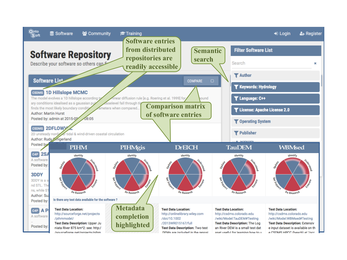
Development of a Framework of Data Interpolation, Scaling, and Homogenization (DISH)

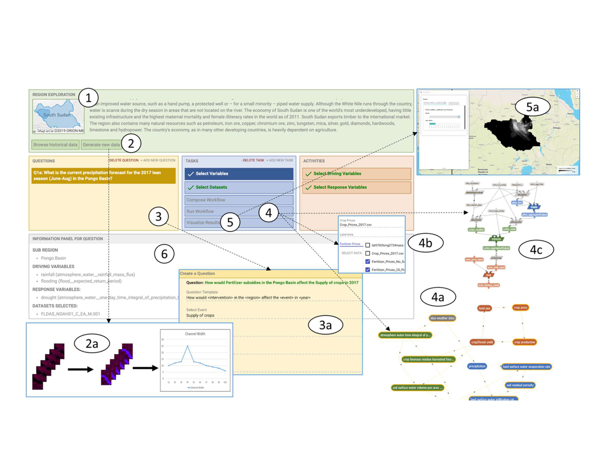
Towards a Shared Modeling Terminology and Problem Specification Framework
Selected talks and posters
- Estimating Inundation Extent and Depth from National Water Model Outputs and High Resolution Topographic Data, NOAA, 2021
- Vector and Raster GIS Processing with Python in Jupyter Notebooks, TACC Institute of Planet Texas 2050, 2020
- DataX and MINT Overview, Planet Texas 2050 Fall Research Showcase, 2019
- MINT: An intelligent interface for understanding the impacts of climate change on hydrological, agricultural and economic systems, AGU, 2019
- A unified data representation of Texas water resources, EarthCube, 2019