
Daniel Hardesty Lewis
I work on urban planning, land-use politics, geospatial data systems, and predictive tools for housing, hazards, and real-estate decisions.
I am completing an M.S. in Urban Planning at Columbia GSAPP. My recent work includes parcel-level modeling of zoning opposition in Austin, terrain and flood workflows for Texas, and valuation models built from large property datasets.
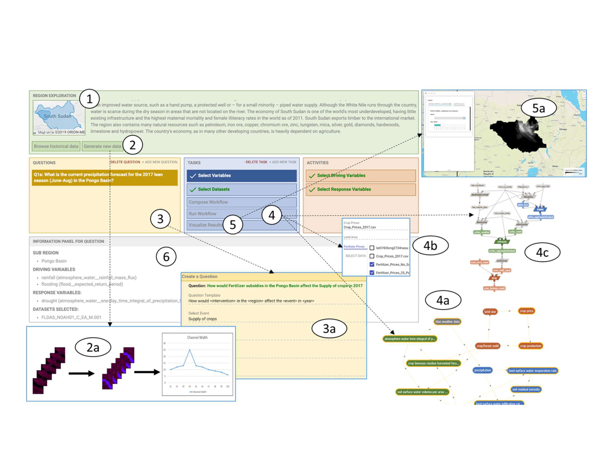
My current interests are geospatial AI for planning, remote sensing and LiDAR-driven urban analysis, urban environmental modeling, and decision tools that connect research to public-facing applications. Previously, I worked at the Texas Advanced Computing Center and on the MINT project.

Research interests
- Land use, zoning politics, redevelopment conflict, and housing markets
- Terrain, inundation, and urban environmental modeling from LiDAR and spatial data
- Predictive tools for planners, public agencies, and property-scale decision making
- GeoAI methods for raster, vector, remote sensing, and large urban datasets
Selected publications
Selected projects
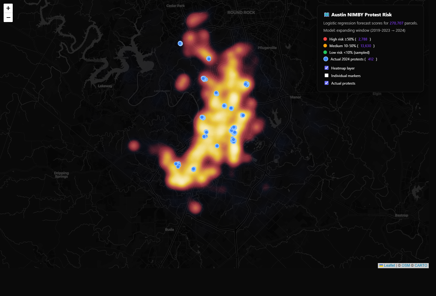
Parcel- and owner-level modeling of rezoning opposition in Austin, Texas.
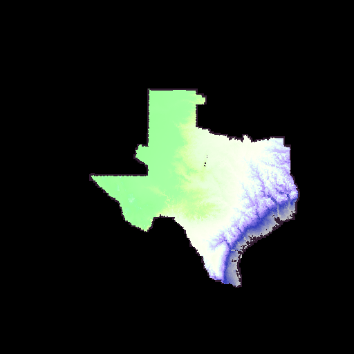
Statewide terrain aggregation and data delivery from many LiDAR and DEM sources.
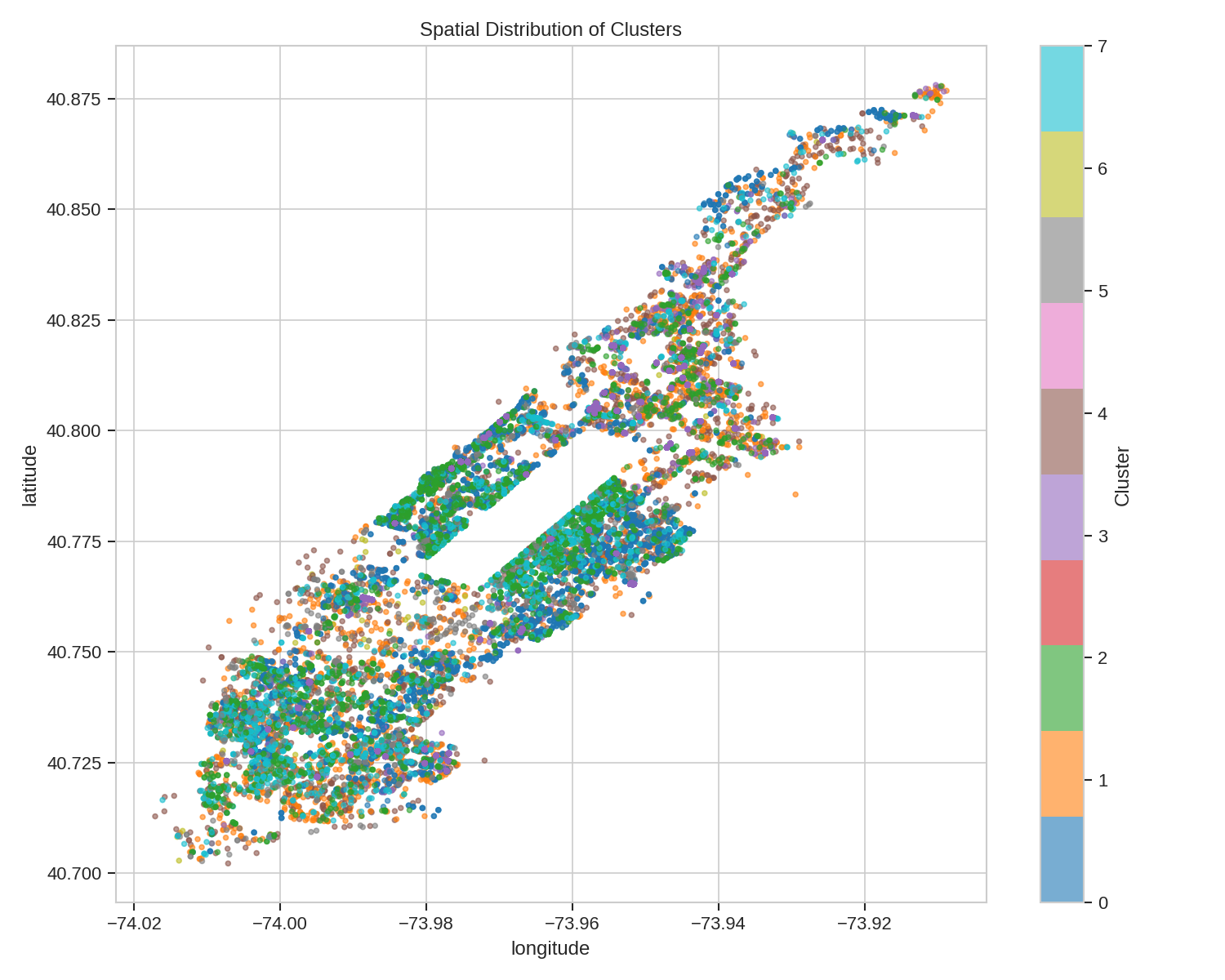
Parcel-level valuation modeling for Manhattan using PLUTO and ACRIS data.
Prototype software for evaluating accessory dwelling unit feasibility in Austin.